First -Bachalpsee - BussalpWalk 8008
Canton - Bern / Berne - Jungfrau Region
Author - Lou Johnson
Length - 9.0 km / 5.6 miles
Ascent - 260 metres / 858 feet
Descent - 660 metres / 2178 feet
Time - 3.25 hours
Grade - moderate
Click image to visit gallery of 12 images.
This route includes a varied mix of scenery and although the majority of the walk is on good paths there is one section where you need to clamber over rocks. However even on this section no technical difficulties will be experienced.
Start - top station of the Grindelwald to First gondola lift. This provides a comfortable and scenic ascent with connections in Grindelwald by train and post bus from throughout the area. See Transport Map for the Jungfrau Region.
End - the small restaurant at Bussalp from where Post Buses connect to Grindelwald.
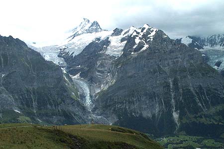
From the top station of the First gondola lift take the broad path signed to Bachalpsee and the Faulhorn. The route climbs steadily offering excellent views ahead to the Reeti and across the valley to the Eiger and beyond. Levelling out, the path becomes easier to drop down to the shores of the Bachalpsee. This is a popular spot and you will probably have to share the scenery with other walkers.
Turn left off the main path to Bussalp, forking right almost immediately at the first path junction. The path climbs onto the southeast ridge of the Reeti where a choice of rocky resting places provide a great place to take in the views. Turn right and walk steeply up the ridge for a short way taking care to follow the red and white waymarks. The path then descends west through a rocky landscape and for a short way you need to scramble over the rocks. The way ahead is well marked and you should have no problems reaching a more straightforward path at the end of the bouldery section.
The path descends across the southern slopes of the Reeti to the reach a path junction. Continue straight ahead to reach a further junction where you keep right with the path soon dropping to cross a stream. Once across the stream the path crosses open alpine meadows to reach the cheese farm at Oberläger. From here take the track, using cut-off paths where appropriate, to descend to Bussalp.
Suggested Maps
 Landeskarte der Schweiz - 1:50000 - Sheet SW 5004 - Berner Oberland
Landeskarte der Schweiz - 1:25000 - Sheet SW 2520 - Jungfrau Region
Wanderkarte - Wengen, Mürren & Lauterbrunnental - 1:40000
Recommended Books
Alpine Flowers
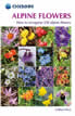 A pocket field guidebook for identifying 230 of the most commonly found alpine flowers of the Alps. Categorised by colour for quick identification, each alpine flower has a photograph and description of its key features. Flower names are given in English, French, German, Italian and Latin, with notes on curious facts and origins of names.
Across the Eastern Alps: E5
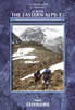 From Lake Constance in Germany, this guidebook describes walking the E5 trek that runs 600km through a remarkable kaleidoscope of landscapes and culture in Switzerland, Austria and Italy, to its destination at Verona. It traverses the Allgauer, Lechtaler and Ötztaler Alps. There is a good network of alpine refuges and guesthouses on the route.
Stay Safe
Do enjoy yourself when out walking and choose a route that is within your capabilities especially with regard to navigation.
Do turn back if the weather deteriorates especially in winter or when visibility is poor.
Do wear the right clothing for the anticipated weather conditions. If the weather is likely to change for the worse make sure you have enough extra clothing in your pack.
Do tell someone where you are planning to walk especially in areas that see few other walkers.
Do take maps and other navigational aids. Do not rely on mobile devices in areas where reception is poor. Take spare batteries especially in cold weather.
Do check the weather forecast before leaving.
Do do not exceed your capabilities.
Please Note - These walks have been published for use by site visitors on the understanding that Walking Sitzerland is not held responsible for the safety or well being of those following the routes as described. It is worth reiterating the point that you should embark on a walk with the correct maps at the most detailed scale where possible. This will enable any difficulties with route finding to be assessed, and corrective action taken if necessary.