Kleine Scheidegg - WengenWalk 8012
Canton - Bern / Berne - Jungfrau Region
Author - Lou Johnson
Length - 6.5 km / 4.1 miles
Ascent - nominal or unknown
Descent - 785 metres / 2591 feet
Time - 2.00 hours
Grade - easy/moderate
Click image to visit gallery of 3 images.
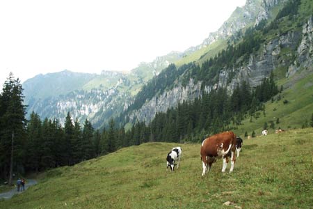
This is a straightforward walk that is downhill all the way. The views are mainly in front of you with the deep Lauterbrünnen valley the main feature. In addition you get good views of the mountains that surround this valley including the Schilthorn.
Start - Kleine Scheidegg station which can be reached by regular train service from Grindelwald and Wengen. See Transport Map for the Jungfrau Region.
End - Wengen station from where there is a regular train service to Grindelwald and Lauterbrünnen.
From Kleine Scheidegg station take the clearly signed path south west. It is on the opposite side of the tracks to the station and immediately starts to descend with the railway on your right hand side. At Wengeralp you cross the railway losing sight of it on some sections prior to Allmend.
Crossing the railway once again the path continues down to Wengen. By the time you arrive in this popular alpine resort your knees may feel that walking downhill is not as easy as it sounds!
Suggested Maps
 Landeskarte der Schweiz - 1:50000 - Sheet SW 5004 - Berner Oberland
Landeskarte der Schweiz - 1:25000 - Sheet SW 2520 - Jungfrau Region
Wanderkarte - Wengen, Mürren & Lauterbrunnental - 1:40000
Recommended Books
Trekking in the Silvretta and Rätikon Alps
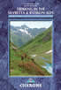 This guide describes three treks, between 5 and 8 days, in the Silvretta and Rätikon Alps starting near Klosters, and 12 half-day hut-to-hut routes. These contrasting ranges form a line on the borders of Switzerland, Austria and Liechtenstein. The Tour of the Silvretta, the Prättigauer Höhenweg and the Rätikon Höhenweg.
Walks in the Engadine - Switzerland
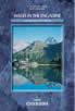 A walking guidebook to 100 day walks in the Engadine, Val Bregaglia, neighbouring valleys and the Engadine National Park. Varying from gentle rambles to adventurous high-level routes for the experienced mountain walker. Each route ranges from 2 to 10 miles long, visiting forests and meadows, high mountain landscapes, lakes and passes.
Stay Safe
Do enjoy yourself when out walking and choose a route that is within your capabilities especially with regard to navigation.
Do turn back if the weather deteriorates especially in winter or when visibility is poor.
Do wear the right clothing for the anticipated weather conditions. If the weather is likely to change for the worse make sure you have enough extra clothing in your pack.
Do tell someone where you are planning to walk especially in areas that see few other walkers.
Do take maps and other navigational aids. Do not rely on mobile devices in areas where reception is poor. Take spare batteries especially in cold weather.
Do check the weather forecast before leaving.
Do do not exceed your capabilities.
Please Note - These walks have been published for use by site visitors on the understanding that Walking Sitzerland is not held responsible for the safety or well being of those following the routes as described. It is worth reiterating the point that you should embark on a walk with the correct maps at the most detailed scale where possible. This will enable any difficulties with route finding to be assessed, and corrective action taken if necessary.