Stechelberg - LauterbrunnenWalk 8023
Canton - Bern / Berne - Jungfrau Region
Author - Lou Johnson
Length - 7.0 km / 4.4 miles
Ascent - nominal or unknown
Descent - 115 metres / 380 feet
Time - 1.75 hours
Grade - easy
Click image to visit gallery image.
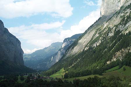
An easy walk that enables you explore the deep Lauterbrünnen valley with its steep cliffs soaring up to high mountain summits.
Start - The village of Stechelberg which is served by Post Bus services from Lauterbrünnen from where trains connect to Wengen, Grindelwald and Interlaken. See Transport Map for the Jungfrau Region.
End - Lauterbrünnen village from where you can return by bus to Stechelberg or use the train services detailed above.
From the centre of Stechelberg village (a short distance south of the bus terminus), take the signed footpath to Lauterbrünnen. You cross the river and continue on the west bank to join a quiet lane at Stegmatten. Continue on this lane to reach Lauterbrünnen without any further problems.
Suggested Maps
 Landeskarte der Schweiz - 1:50000 - Sheet SW 5004 - Berner Oberland
Landeskarte der Schweiz - 1:25000 - Sheet SW 2520 - Jungfrau Region
Wanderkarte - Wengen, Mürren & Lauterbrunnental - 1:40000
Recommended Books
Alpine Flowers
 A pocket field guidebook for identifying 230 of the most commonly found alpine flowers of the Alps. Categorised by colour for quick identification, each alpine flower has a photograph and description of its key features. Flower names are given in English, French, German, Italian and Latin, with notes on curious facts and origins of names.
The Tour of the Bernina
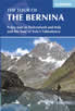 Guidebook describing a 9-stage (119km) route around the Piz Bernina massif in the Alps on the Swiss-Italian border near St Moritz, and the 8-stage (94km) Alta Via Valmalenco exploring the Valmalenco valley, in the shadow of Monte Disgrazia. The Tour of the Bernina is suitable for first-time trekkers but the Alta Via needs some experience.
Stay Safe
Do enjoy yourself when out walking and choose a route that is within your capabilities especially with regard to navigation.
Do turn back if the weather deteriorates especially in winter or when visibility is poor.
Do wear the right clothing for the anticipated weather conditions. If the weather is likely to change for the worse make sure you have enough extra clothing in your pack.
Do tell someone where you are planning to walk especially in areas that see few other walkers.
Do take maps and other navigational aids. Do not rely on mobile devices in areas where reception is poor. Take spare batteries especially in cold weather.
Do check the weather forecast before leaving.
Do do not exceed your capabilities.
Please Note - These walks have been published for use by site visitors on the understanding that Walking Sitzerland is not held responsible for the safety or well being of those following the routes as described. It is worth reiterating the point that you should embark on a walk with the correct maps at the most detailed scale where possible. This will enable any difficulties with route finding to be assessed, and corrective action taken if necessary.