Fuorcla Surlej - Coaz Hutte Walk 8059
Canton - Graubunden/Grisons - Upper Engadine
Author - Lou Johnson
Length - 6.0 km / 3.8 miles
Ascent - 90 metres / 297 feet
Descent - 235 metres / 776 feet
Time - 2.00 hours
Grade - easy/moderate
Click image to visit gallery image.
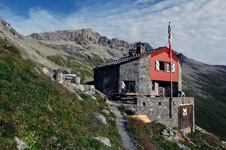
This walk deep into the mountains offers grand panoramas and relatively easy walking. However, it must be remembered that in bad weather it is a long walk back out to transport and safety. The route is easy to follow, has little ascent and you can enjoy well-earned refreshments at the Coaz Hütte.
From Fuorcla Surlej take the descending path signed to Val Roseg and Coaz Hütte. Reaching a junction of paths (2722 m), go left and traverse the valley side losing some altitude in the process. A second junction is soon reached (2569 m) and here you continue straight ahead. At a fork (2657 m) keep to the right and continue past the junction with the path coming up from the valley (2645 m).
The final stretch to the Refuge provides some of the most remembered views especially north along the valley with Lej da Vadret far below. Ahead are the intimidating rock walls with the summits of Piz Glü:schaint and La Sella (amongst other peaks) soaring high above you.
To return you can either retrace the route back to Fuorcla Surlej and onto to the cable car at Murtel or follow Walk 8060 down into the valley, along the shores of Lej da Vadret and onwards to Restaurant Roseg. From here it is an easy walk back to Pontresina.
Suggested Maps
 Oberengadin, Bergell-Puschlav, Wanderkarte - 1:50000
Recommended Books
Alpine Flowers
 A pocket field guidebook for identifying 230 of the most commonly found alpine flowers of the Alps. Categorised by colour for quick identification, each alpine flower has a photograph and description of its key features. Flower names are given in English, French, German, Italian and Latin, with notes on curious facts and origins of names.
Tour of the Matterhorn
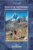 A guide to the 145km Tour of the Matterhorn, described anti-clockwise from Zermatt and visits 6 valleys via Zinal, Arolla and Breuil, offering spectacular views of 25 peaks of over 4000m. The route also links up with the Chamonix to Zermatt walkers' Haute Route and the Tour of Monte Rosa. Includes two glacier crossings and takes 8 to 10 days.
Stay Safe
Do enjoy yourself when out walking and choose a route that is within your capabilities especially with regard to navigation.
Do turn back if the weather deteriorates especially in winter or when visibility is poor.
Do wear the right clothing for the anticipated weather conditions. If the weather is likely to change for the worse make sure you have enough extra clothing in your pack.
Do tell someone where you are planning to walk especially in areas that see few other walkers.
Do take maps and other navigational aids. Do not rely on mobile devices in areas where reception is poor. Take spare batteries especially in cold weather.
Do check the weather forecast before leaving.
Do do not exceed your capabilities.
Please Note - These walks have been published for use by site visitors on the understanding that Walking Sitzerland is not held responsible for the safety or well being of those following the routes as described. It is worth reiterating the point that you should embark on a walk with the correct maps at the most detailed scale where possible. This will enable any difficulties with route finding to be assessed, and corrective action taken if necessary.