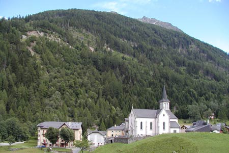
Trient - Chalet du Glacier - TrientWalk 8102
Canton - Valais / Wallis - Vallee du Trient
Author - Trient Office de Tourisme
Length - 8.0 km / 5 miles
Ascent - 310 metres / 1023 feet
Descent - 310 metres / 1023 feet
Time - 2.75 hours
Grade - easy/moderate
Click image to visit gallery of 3 images.
This is a straightforward hike on easily graded paths. There are no difficulties with navigation.
Start & End - the village of Trient, 10 km. southwest of Martigny (VS).
From the village church walk up to the main road. Turn right in the direction of Forclaz. After a short distance along the road, take the signed track on the left which directs you to the Sentier du Bisse-Glacier. This leads you uphill to reach the main road to Forclaz. Go straight across the road and onto the track/footpath.
Height is gained as you zig-zag upwards. Meeting the transverse path from Forclaz, turn right and follow the drainage channel (bisse) south towards the Glacier du Trient. Almost level the path threads through trees with occasional views across the valley to the Col de Balme.
You reach the Chalet du Glacier (1583 m.) where refreshments are available in season. A grand view of the Glacier can be enjoyed whilst you take a break. For those with energy to spare you can walk closer to the foot of the glacier.
Leave the Chalet du Glacier on the same path used for the outward route and take the first path left. Cross the footbridge over the glacial river and turn right. This path leads to a metalled lane that will take you back to Trient.
Suggested Maps
 Landeskarte der Schweiz - 1:50000 - Sheet SW 5003 - Mont Blanc - Grand Combin
Recommended Books
The Tour of the Bernina
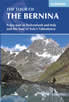 Guidebook describing a 9-stage (119km) route around the Piz Bernina massif in the Alps on the Swiss-Italian border near St Moritz, and the 8-stage (94km) Alta Via Valmalenco exploring the Valmalenco valley, in the shadow of Monte Disgrazia. The Tour of the Bernina is suitable for first-time trekkers but the Alta Via needs some experience.
Tour of Monte Rosa
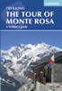 A guidebook to walking the The Tour of Monte Rosa, a 9-10 day, 134km trek circling Monte Rosa anti-clockwise from Zermatt. The high route hugs glaciers and has views of over ten 4000ers. All essential information is provided, including outline maps, route profiles, advice on glacier crossing and accommodation.
Stay Safe
Do enjoy yourself when out walking and choose a route that is within your capabilities especially with regard to navigation.
Do turn back if the weather deteriorates especially in winter or when visibility is poor.
Do wear the right clothing for the anticipated weather conditions. If the weather is likely to change for the worse make sure you have enough extra clothing in your pack.
Do tell someone where you are planning to walk especially in areas that see few other walkers.
Do take maps and other navigational aids. Do not rely on mobile devices in areas where reception is poor. Take spare batteries especially in cold weather.
Do check the weather forecast before leaving.
Do do not exceed your capabilities.
Please Note - These walks have been published for use by site visitors on the understanding that Walking Sitzerland is not held responsible for the safety or well being of those following the routes as described. It is worth reiterating the point that you should embark on a walk with the correct maps at the most detailed scale where possible. This will enable any difficulties with route finding to be assessed, and corrective action taken if necessary.