Sulwald - LobhornhutteWalk 8029
Canton - Bern / Berne - Jungfrau Region
Author - Lou Johnson
Length - 3.0 km / 1.9 miles
Ascent - 420 metres / 1386 feet
Descent - nominal or unknown
Time - 1.50 hours
Grade - easy/moderate
Click image to visit gallery of 9 images.
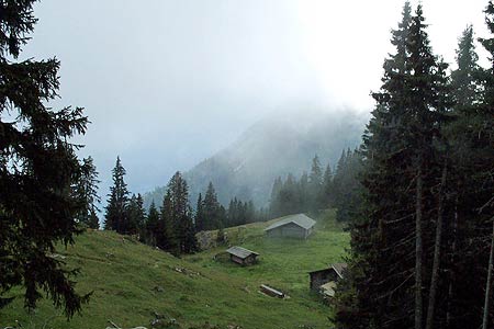
This short walk explores an area above Lauterbrunnen away from the tourist crowds. The main objective, the Lobhornhütte, is a wonderful place to relax and enjoy a special view of the Eiger, Mönch and Jungfrau.
Start the top station of the cable car from Isenfluh to Sulwald. This cablecar can be reached by mini-bus from Lauterbrunnen railways station. See Transport Map for the Jungfrau Region.
End the Lobhornhütte. From here you can continue down to Saxeten by following route 8030 or return by the outward route to Sulwald.
Exit the top station of the Isenfluh-Sulwald cable car and bear left along a lane. This area is very quiet with little of the commercialisation seen in other parts of this area. Quite soon a path branches right signed to the Lobhornhütte. The path climbs up through forest to reach a junction. The left fork goes to Chüebodmi, with the right fork taking us higher towards the Lobhornhütte. The path leaves the forest to enter delightful alpine meadows and the retrospective view is superb.
Reaching the alpine farm of Suls, bear right and continue up to the delightful lake of Sulsseeli. Continue around the right hand shore of the lake and then a few minutes past the end of the lake follow the path branch up to your right. This leads to the Lobhornhütte. The views are stupendous. The welcome excellent making this a wonderful place to rest and enjoy the view.
Suggested Maps
 Landeskarte der Schweiz - 1:50000 - Sheet SW 5004 - Berner Oberland
Landeskarte der Schweiz - 1:25000 - Sheet SW 2520 - Jungfrau Region
Wanderkarte - Wengen, Mürren & Lauterbrunnental - 1:40000
Recommended Books
Walking in the Bernese Oberland
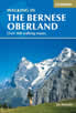 This walking guidebook to the Bernese Oberland describes 113 day walks. Routes range from 2 to 24km and offer breathtaking scenery of the classic Eiger, Mönch and Jungfrau mountains, around Grindelwald, Lauterbrunnen, Gsteig and Meiringen. There are routes suitable for all abilities from short flat walks to adventurous treks.
100 Hut Walks in the Alps
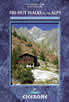 This guidebook has route descriptions for 100 day walks to suit alpine walkers of all abilities, with suggestions for some hut-to-hut tours. These routes take you through breathtaking scenery in the Maritime Alps, Julian Alps, Gran Paradiso, the Turnitzer Alps, Bernese Oberland, the Kitzbuheler Alps and the Dolomites of South Tirol.
Stay Safe
Do enjoy yourself when out walking and choose a route that is within your capabilities especially with regard to navigation.
Do turn back if the weather deteriorates especially in winter or when visibility is poor.
Do wear the right clothing for the anticipated weather conditions. If the weather is likely to change for the worse make sure you have enough extra clothing in your pack.
Do tell someone where you are planning to walk especially in areas that see few other walkers.
Do take maps and other navigational aids. Do not rely on mobile devices in areas where reception is poor. Take spare batteries especially in cold weather.
Do check the weather forecast before leaving.
Do do not exceed your capabilities.
Please Note - These walks have been published for use by site visitors on the understanding that Walking Sitzerland is not held responsible for the safety or well being of those following the routes as described. It is worth reiterating the point that you should embark on a walk with the correct maps at the most detailed scale where possible. This will enable any difficulties with route finding to be assessed, and corrective action taken if necessary.