Bernina Ospizio - Alp Grum Walk 8055
Canton - Graubunden/Grisons - Upper Engadine
Author - Lou Johnson
Length - 6.0 km / 3.8 miles
Ascent - 20 metres / 66 feet
Descent - 170 metres / 561 feet
Time - 2.00 hours
Grade - easy
Click image to visit gallery of 15 images.
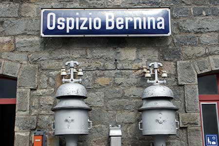
This easy walk takes you through the wild terrain of the Bernina Pass. The start is the railway station of Bernina Ospizio (2253m) which is served by regular trains between Pontresina and Tirano on the Bernina line of the Rhaetian Railway. Connections are also available from St. Moritz, the Lower Engadine and beyond.
Alighting at Ospizio Bernina you can see the extensive Lago Bianco with almost white waters reflecting the blue sky (or dark clouds on some days). Leave the station following the signs for Alp Grüm. Initially the path is above the railway but soon crosses the railway and follows the shores of Lago Bianco which are on your immediate right. The path is almost level and walking is easy and you can relax and enjoy this wilderness.
Reaching the southern end of Lago Bianco, you pass a substantial arched dam on your right and descend on a clear track with the railway hidden in snow sheds to your left. At Mot (2162m) keep straight ahead keeping the railway on your immediate left. (alternatively you can stay on the main track veering left and follow this down to Alp Grüm) The path continues to descend and crosses the railway, climbing slightly. The upper choice of routes is probably better providing better views to reach a narrow road. Turn right here and Alp Grüm and welcome refreshments are short way ahead.
Suggested Maps
 Oberengadin, Bergell-Puschlav, Wanderkarte - 1:50000
Recommended Books
Alpine Flowers
 A pocket field guidebook for identifying 230 of the most commonly found alpine flowers of the Alps. Categorised by colour for quick identification, each alpine flower has a photograph and description of its key features. Flower names are given in English, French, German, Italian and Latin, with notes on curious facts and origins of names.
The Swiss Alps
 A comprehensive guidebook to every mountain area in the Swiss Alps. This handy resource includes information for walking, hiking, trekking, climbing and ski mountaineering. Access, accommodation and facilities in the valley bases and full information about Swiss mountain huts is included to help you make the most out of a trip there.
Stay Safe
Do enjoy yourself when out walking and choose a route that is within your capabilities especially with regard to navigation.
Do turn back if the weather deteriorates especially in winter or when visibility is poor.
Do wear the right clothing for the anticipated weather conditions. If the weather is likely to change for the worse make sure you have enough extra clothing in your pack.
Do tell someone where you are planning to walk especially in areas that see few other walkers.
Do take maps and other navigational aids. Do not rely on mobile devices in areas where reception is poor. Take spare batteries especially in cold weather.
Do check the weather forecast before leaving.
Do do not exceed your capabilities.
Please Note - These walks have been published for use by site visitors on the understanding that Walking Sitzerland is not held responsible for the safety or well being of those following the routes as described. It is worth reiterating the point that you should embark on a walk with the correct maps at the most detailed scale where possible. This will enable any difficulties with route finding to be assessed, and corrective action taken if necessary.