Sils Maria - Grevasalvas - Maloja Walk 8054
Canton - Graubunden/Grisons - Upper Engadine
Author - Lou Johnson
Length - 8.0 km / 5 miles
Ascent - 310 metres / 1023 feet
Descent - 310 metres / 1023 feet
Time - 3.00 hours
Grade - easy/moderate
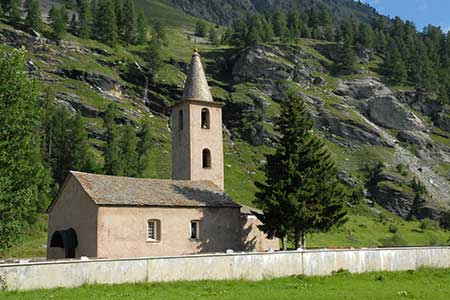
Click image to visit gallery of 15 images.
This walk offers a relatively easy and scenically attractive walk between these two villages in the Engadine. In the early stages of the walk there is some traffic noise but this soon disappears as progress is made towards Maloja. Views across 'Lej da Silva' are excellent and if you are lucky (as we were) you may see Eagles as you gain higher ground. On arrival in Maloja you have two options - either walk back to Sils Maria (6 km) or take the bus which runs every 30 minutes throughout most of the day. Refreshments are limited on this route to the start and end of the walk.
The start of the walk is Sils Maria Post Office (where buses also start). With your back to the Post, turn left , cross the bridge over the river and continue straight ahead towards Sils Baseglia and the main road that bypasses Sils Maria. As a short diversion you can take the footpath on your left that loops around the peninsula. This leads back to the main road before Sils Baseglia.
Cross the main road (with care) and follow the footpath signed to Grevasalvas. Turn left onto a track and almost immediately bear left onto a narrower path. You are now on the Via Engadina. Continue ahead ignoring a path on your right (after 400 metres) and continue to a fork in the path where you ignore the left hand path signed to Plaun da Lej. The path climbs gradually and the scenery improves. You reach a further junction (2011 metres) where you turn left and down following the sign pointing to Grevasalva (10 minutes).
Continue through Grevasalvas turning right at T-junction signed to Blaunca. You are now on a broad track. After just under a kilometre you reach Blaunca (2037 metres) where you cross the stream and continue ahead. The next section of the route is delightful as you walk between alpine meadows and then across the hillside. Ahead are some wonderful mountain panoramas. Ignore a footpath on your left (by a bench at 1945 metres) and continue for another 100 metres to a path junction. Here you go left signed Pila.
Descend steep steps and turn left at a path junction in the hamlet of Pila. Follow the broad gravel track ignoring the first path on the right but taking the second path on the right some 25 metres further. This leads down to the main road. Turn right and walk into the centre of Maloja. Buses depart from the Post.
Suggested Maps
 Oberengadin, Bergell-Puschlav, Wanderkarte - 1:50000
Recommended Books
Walking in the Alps
 An outstanding and comprehensive book exploring the walking and trekking possibilities in every Alpine region. Many thousands of possible routes are suggested, from the Maritime Alps of southern France throughout the range to the Julian Alps of Slovenia. Walks vary from undemanding to long and tough, and everything in between.
Alpine Flowers
 A pocket field guidebook for identifying 230 of the most commonly found alpine flowers of the Alps. Categorised by colour for quick identification, each alpine flower has a photograph and description of its key features. Flower names are given in English, French, German, Italian and Latin, with notes on curious facts and origins of names.
Stay Safe
Do enjoy yourself when out walking and choose a route that is within your capabilities especially with regard to navigation.
Do turn back if the weather deteriorates especially in winter or when visibility is poor.
Do wear the right clothing for the anticipated weather conditions. If the weather is likely to change for the worse make sure you have enough extra clothing in your pack.
Do tell someone where you are planning to walk especially in areas that see few other walkers.
Do take maps and other navigational aids. Do not rely on mobile devices in areas where reception is poor. Take spare batteries especially in cold weather.
Do check the weather forecast before leaving.
Do do not exceed your capabilities.
Please Note - These walks have been published for use by site visitors on the understanding that Walking Sitzerland is not held responsible for the safety or well being of those following the routes as described. It is worth reiterating the point that you should embark on a walk with the correct maps at the most detailed scale where possible. This will enable any difficulties with route finding to be assessed, and corrective action taken if necessary.